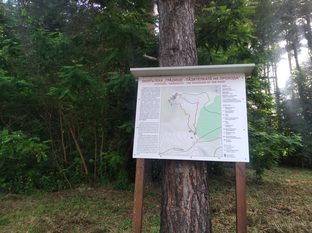
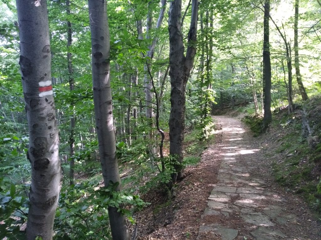
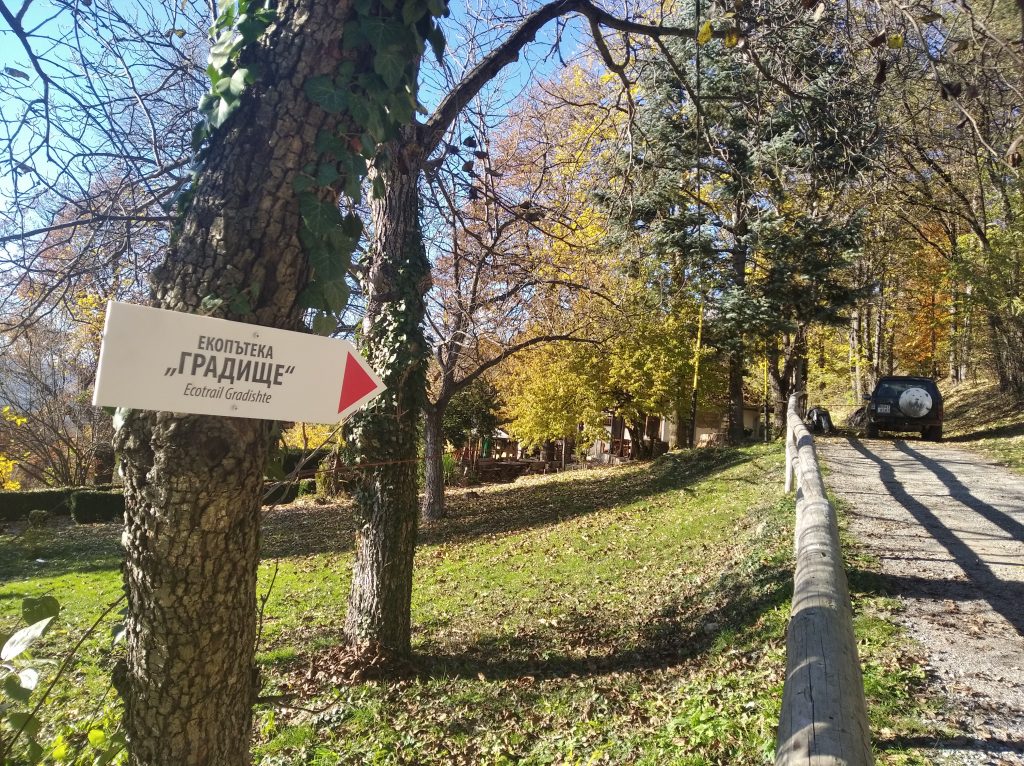
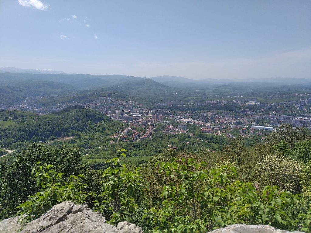
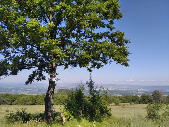
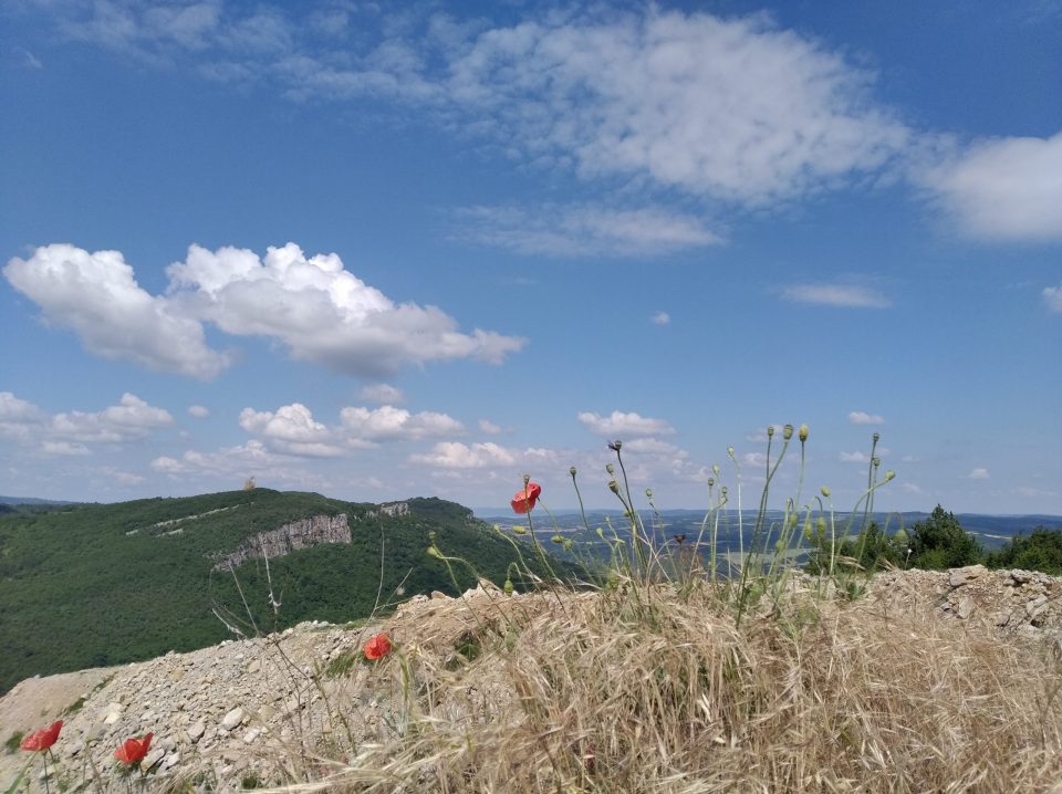
The trail is located only 3 km northeast of Gabrovo and is easy to access. The route is circular, with a slight climb and passes through a cool mixed forest, reaching the fortified settlement at its highest point. There is a viewing site with a panoramic view of a large part of the Balkan, the valley of the Yantra River and the town of Gabrovo. On a clear day you can see the vertical rocks of Vitata Stena and Botev peak.
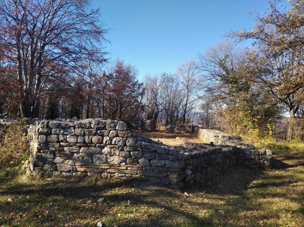
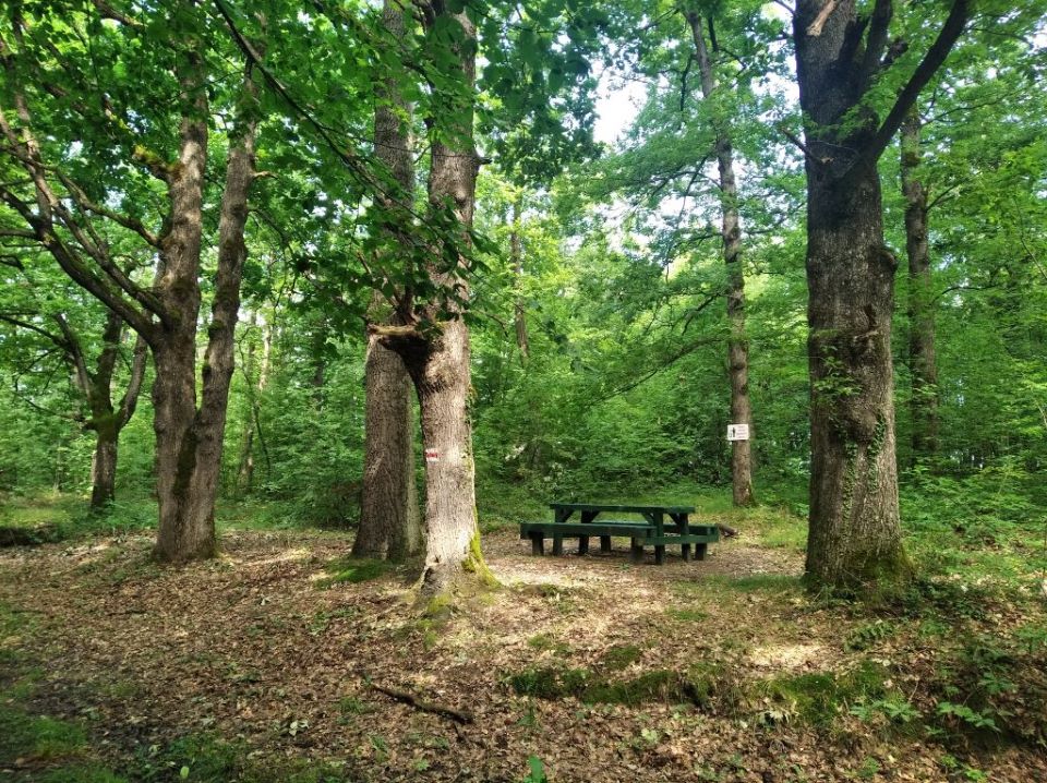
The fortress “Gradishte” is dated by archaeologists as late antique and early medieval (4th-6th century). Gabrovians call the fortress “The Keeper of the Pass” because it was erected during the Roman Empire to guard the main road through the Shipka Pass and to stop the barbarian invasions. It is a fortified settlement, typical for its time. Archaeological excavations have revealed a fortress wall with a length of about 4 km, densely built residential buildings, premises of the garrison guarding the fortress, a main entrance and three watch towers. In the highest part of the fortress is the main temple with a room for baptising, the so-called baptistery. The objects found during the archaeological excavations from the everyday life of the people – old coins, jewellery, beautiful ornaments, tableware, etc., are stored in the Regional Museum of History – Gabrovo.
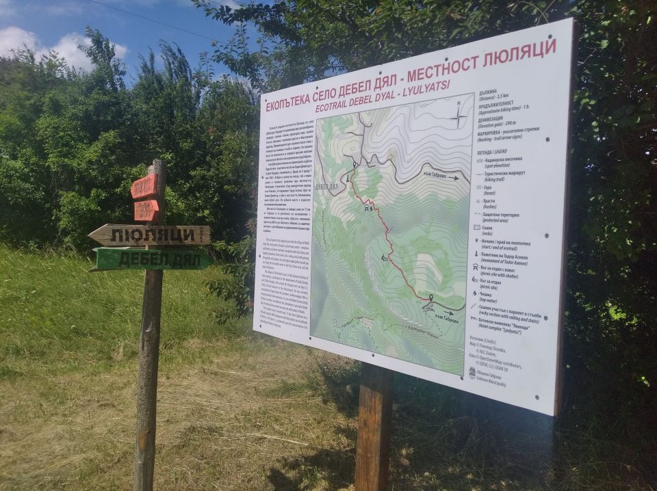
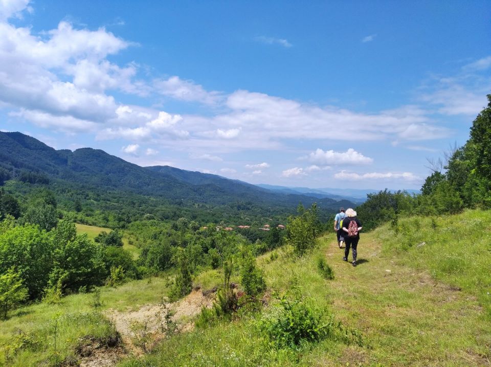
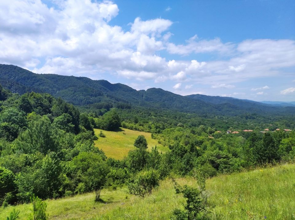
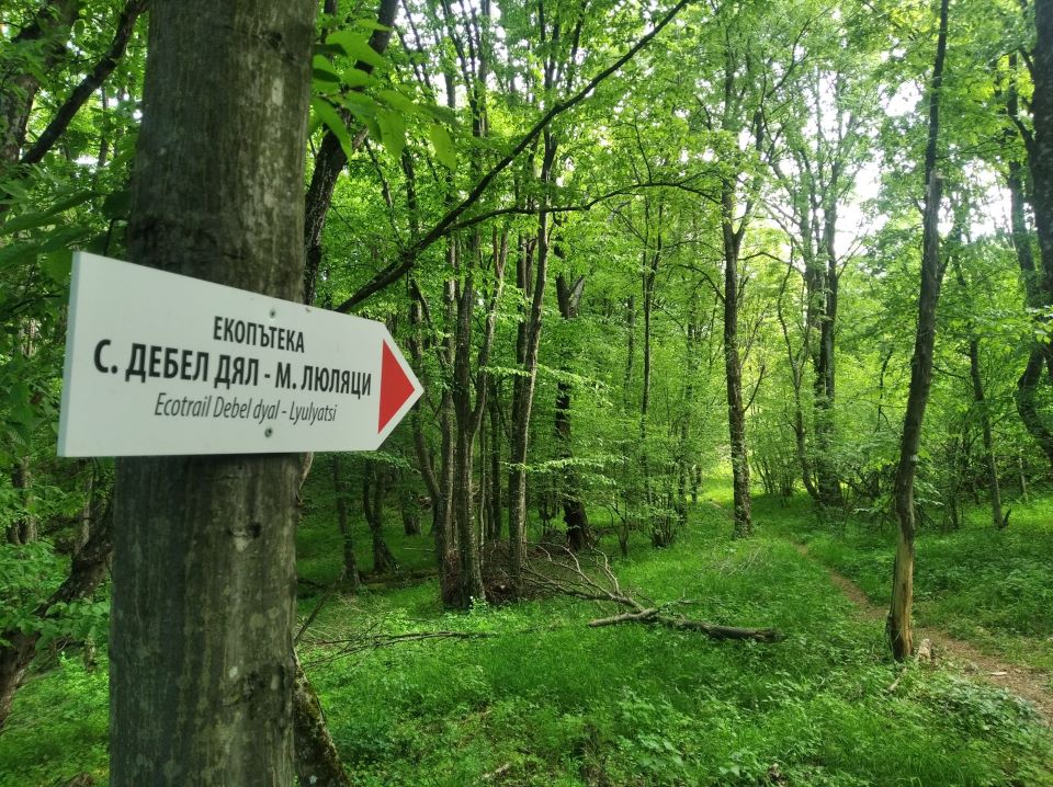
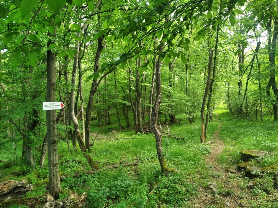
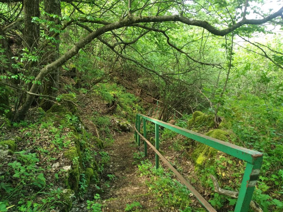
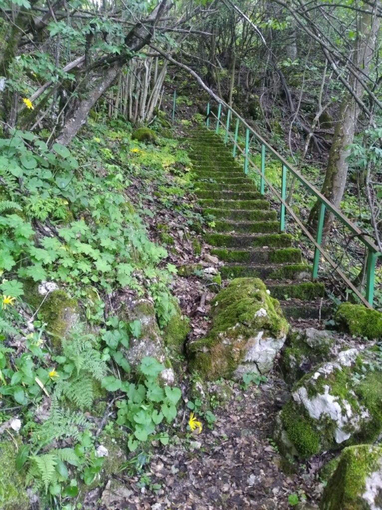
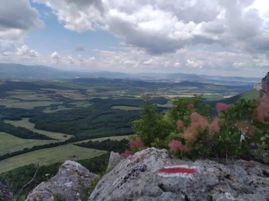
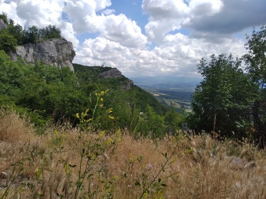
The trail with a length of 3 km connects the area of Lyulyatsite with the picturesque village of Debel Dyal. The route passes through a variety of nature and relief – meadows with herbs, cool forest, rocky slopes, decorated with lilac bushes and fragrant geraniums. The passage through the rock plateau is done with the help of stone stairs and a railing. In several places along the eco-trail there are beautiful landscapes to Vitata Stena area and the town of Gabrovo and the region.
The eco-trail from the village of Iztochnik to the village of Bozhentsi follows an old Roman road, which has existed since the beginning of the 4th century and has been restored in recent decades. The route is about 3.5 km long in one direction and passes through flat woodland. The trail is a preferred option for a more pleasant reach to the picturesque village of Bozhentsi, also known as the Museum of Architectural and Historical Reserve “Bozhentsi”, by both hikers and cyclists.
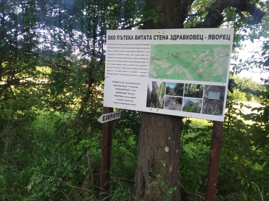
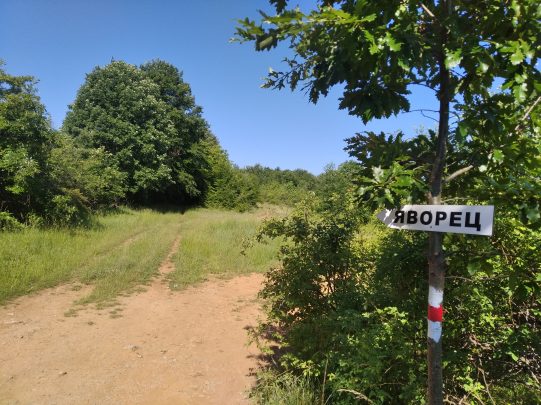
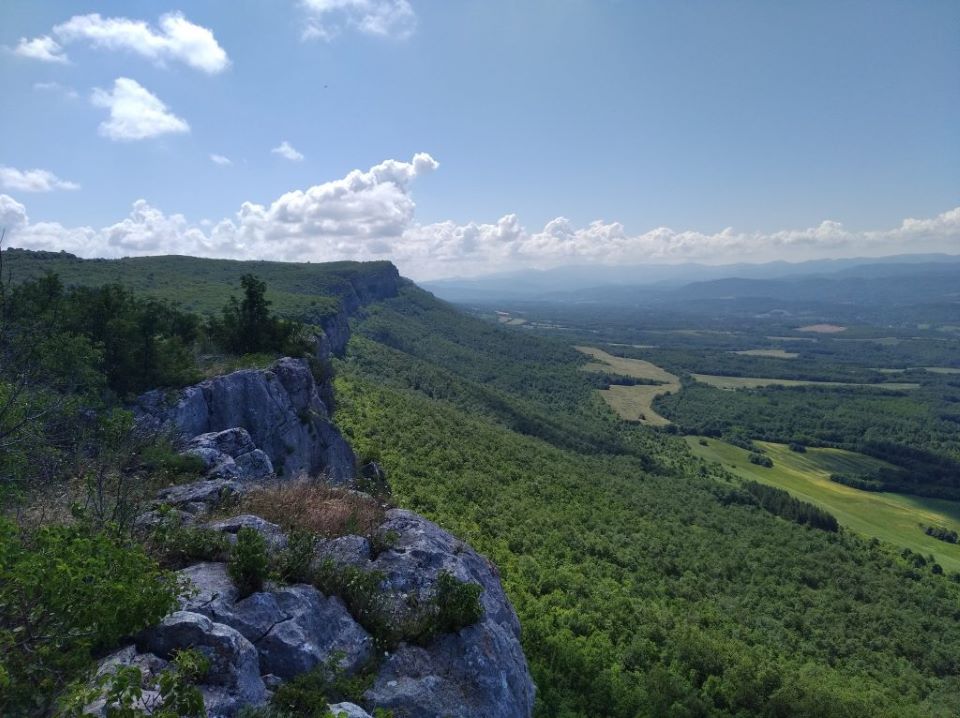
The route between the village of Zdravkovets and the village of Yavorets surrounds most of the plateau of Vitata Stena and is about 8 km long in one direction. It is suitable for both walking and cycling. There are many options for shorter routes and tours depending on the preparation and preferences. The transition between the rock massif and the village of Yavorets is assisted with railings that facilitate climbing / descending.
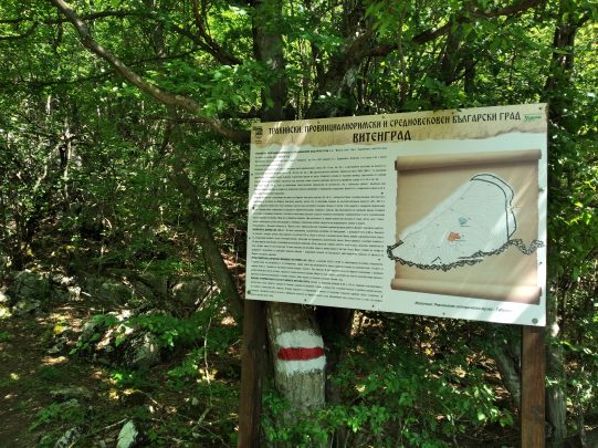
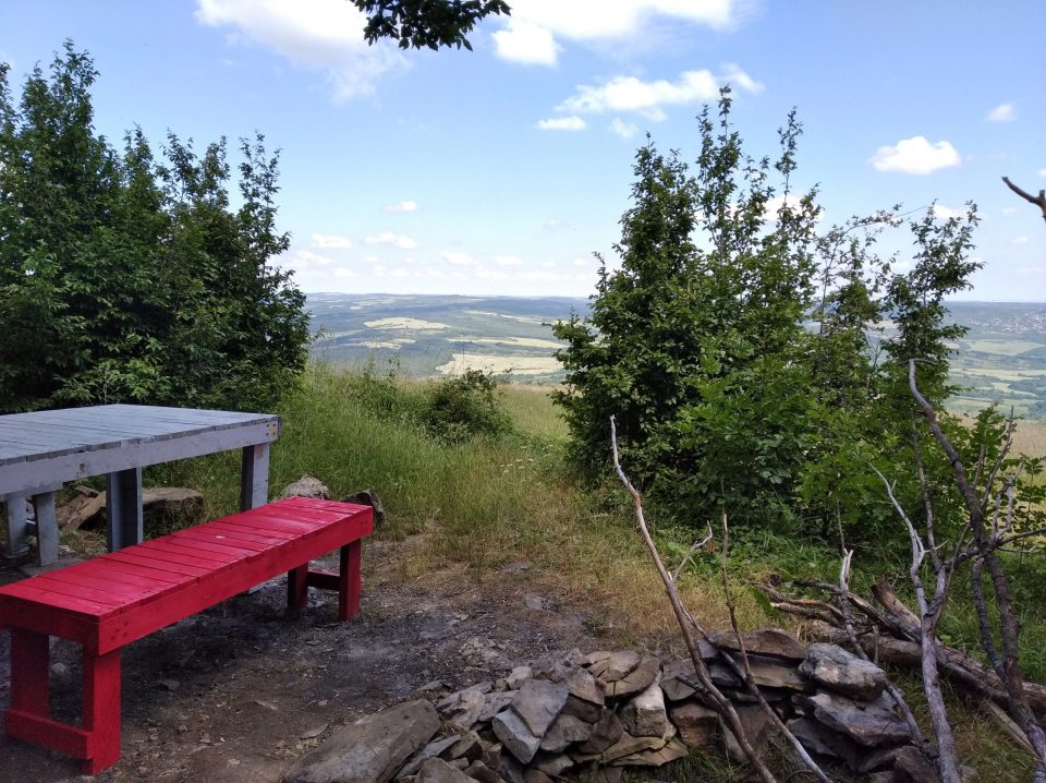
The starting point for the eco-trail is the farm building at the end of the village of Zdravkovets, which is located in the upper part of Vitata Stena. Take the forest road, pass by Belyakovets Lake and reach a fork for Neolithic caves and rock phenomenon “Momichkite”. The main route continues to Zablatenoto Ezero (the Swampy Lake) and Mount Golemiya Repey (Big Burdock). The two paths converge at the northwestern end of the rock wreath, where the remains of the fortress Vitengrad (The Town) are located. From the sheer cliffs there is a magnificent view of the surrounding villages and the peaks of Central Stara Planina. Then there is a steep descent to the village of Yavorets, located at the foot of Vitata Stena. If you approach from the village of Yavorets, the steep section to reach the rocks and plateau is climbing through the forest, about 1-2 km from the beginning of the trail.
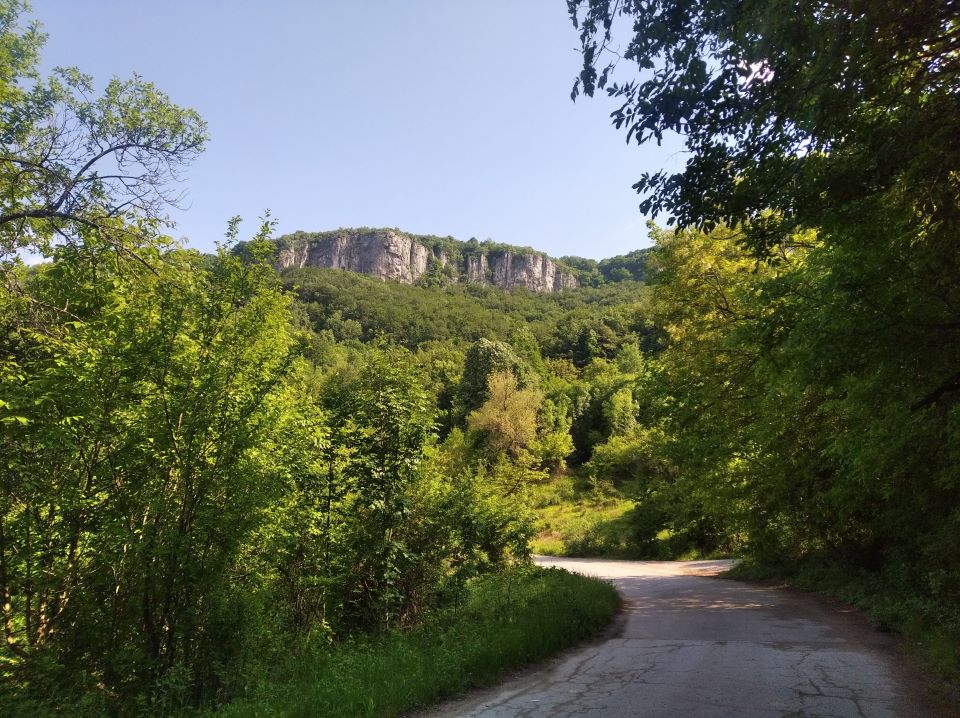
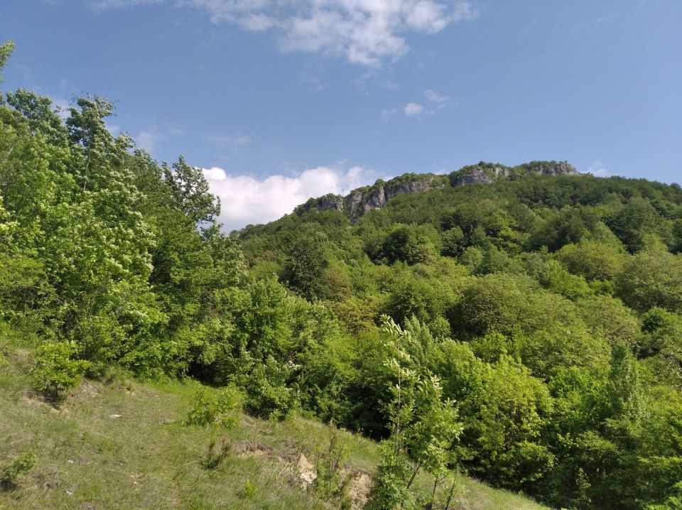
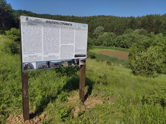
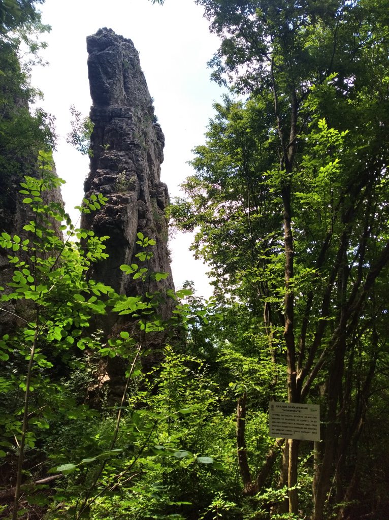
The spiral wall is an impressive arch-shaped rock wreath, which is composed of limestone rocks and is located in the westernmost part of the Strazhata plateau, located between Sevlievo, Dryanovo and Gabrovo. It is part of the NATURA 2000 ecological network as a protected area for the conservation of natural habitats and wild flora and fauna.
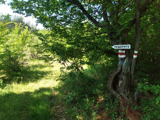
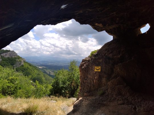
One of the interesting places along the route is the Black Cave (“Chernata cave”), declared a significant underground habitat of bats in Bulgaria. It is located in the protected area BG0000190 “The Winding Wall”, declared by order of the Ministry of Environment and Water № RD-359/31.03.2021. This cave is home of bats and is an important site for their conservation.
The Mysterious World of Bats
When we think of bats, we often associate them with the dark depths of caves. And while not all bats live in them, caves are indeed important for many species. Some spend their entire lives in caves, usually in karst areas. They often form huge colonies, with numbers reaching over 100,000 individuals. This makes them easily vulnerable and requires special protection. Caves are one of the most important habitats for breeding, rearing and overwintering.
Critical Periods for Bats:
Breeding (May 15 – July 30): During this period, pregnant females form colonies where they give birth and raise their young. Any disturbance may result in the abandonment of the young.
Hibernation (1 December – 30 March): During winter, when insects – the bats’ main food – are unavailable, bats go into hibernation. Any disturbance during this period can wake them and deplete their vital energy reserves.
When visiting the Black Cave (“Chernata cave”), observe the following rules:
Avoid visits during critical periods.
Do not make noise or disturb bat colonies.
Do not camp in or in front of the cave.
Do not disturb hibernating bats – do not touch them or take flash photographs.
Do not light fires at cave entrances or enter with torches.
Never throw litter in or around the cave.
Bats are an integral part of our ecosystem and their protection is vital. By following these simple rules, we can help protect these amazing creatures and their habitat. Visiting caves can be a fascinating and enriching experience, especially when we treat their inhabitants with respect.
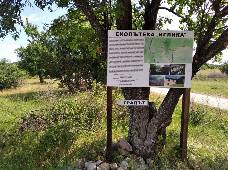
The village of Iglika is located only 13 km northeast of Gabrovo and is “perched” on an impressive rock massif, part of the Strazhata plateau – a beautiful rock chain extending in several tens of kilometers in the direction Dryanovo-Gabrovo-Sevlievo.
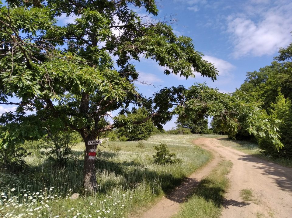
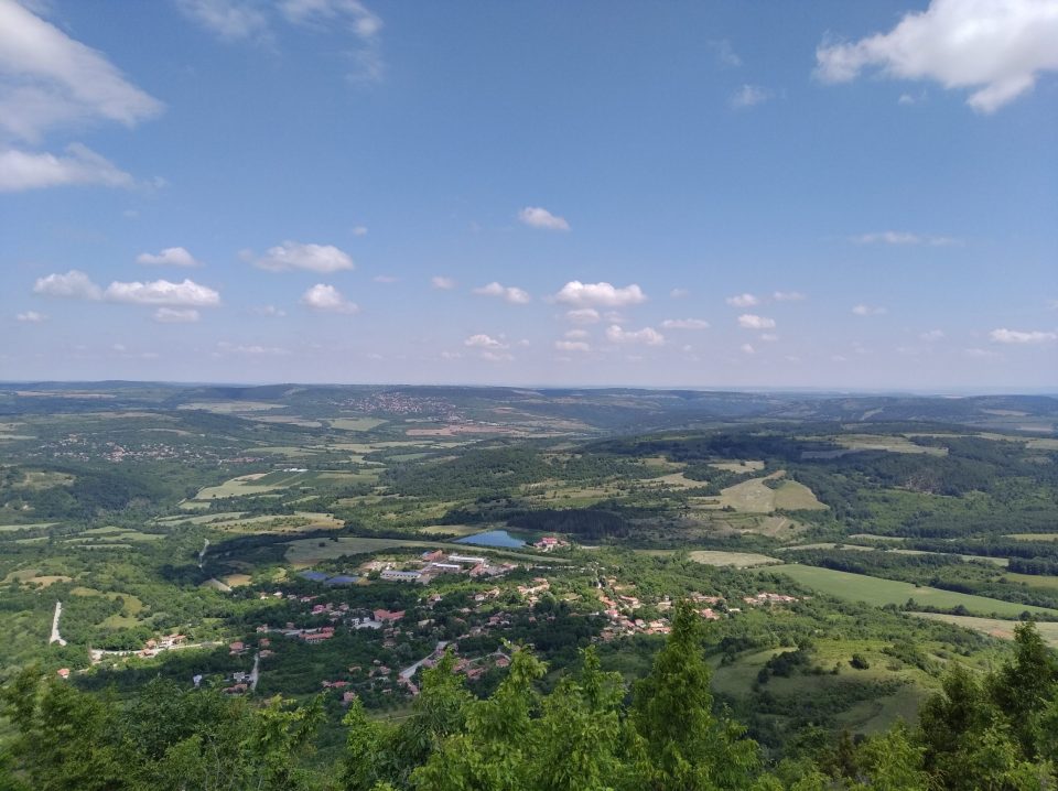
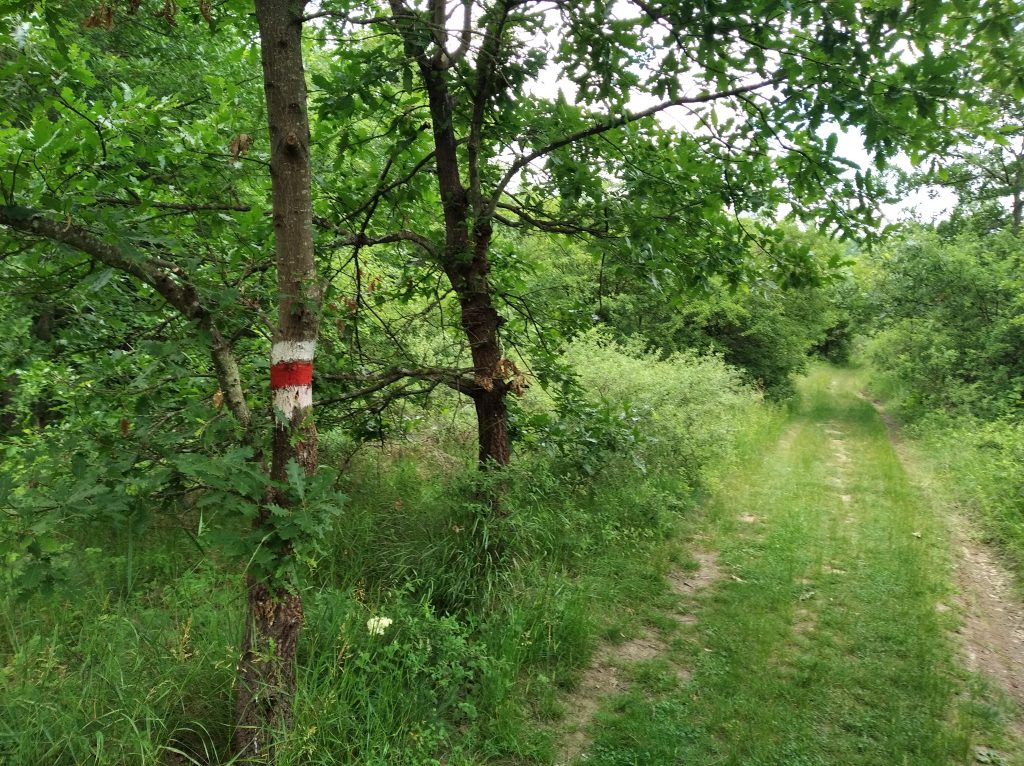
The eco-trail to the village of Iglika is circular and starts from a meadow before the village. From the very beginning of the route wonderful pastoral landscapes to the Balkan and the Fore-Balkan unfold. The start is at a good dirt road that passes directly above the Chirikovets quarry. The trail continues along a marked path and leads to the remains of the fortress “Gradat” (“The City”), also called “Chomashkata skala” (after the old name of the village of Iglika) by going out to a wide place over rocks.
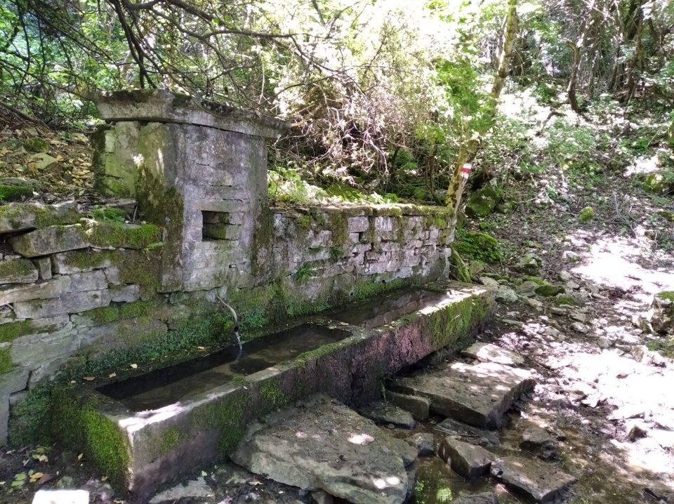
The fortress “Gradat” is a terraced rock hill with an altitude of 615–661 m. During archaeological excavations, remains of the fortress wall and two towers were discovered. The road from Nicopolis ad Istrum passed right on the plateau and led to the pass in the Balkan Mountains. Currently, the terrain there is flattened with earth, from where an incredible panoramic view of the surrounding villages in the valley and the beautiful rock wreaths on both sides is revealed. This place is used as a platform for tandem paragliding flights, with a pylon mounted at the top. An area for relaxation is built under the pylon. From there, through the forest, the path descends into the village of Iglika. Shortly before entering the village, you pass by a functioning fountain with a stone trough.
Another marked trail with a length of about 1 km (in one direction) to the fortress (tower type) on Mount Minin Chukar (704 m) starts from the community centre in the village. The peak is the highest point in the eastern part of the Strazhata plateau. It offers excellent views in all directions. At the very top there are remains of a round or square shape – most probably this is the donjon (main tower) of a fortress built there.
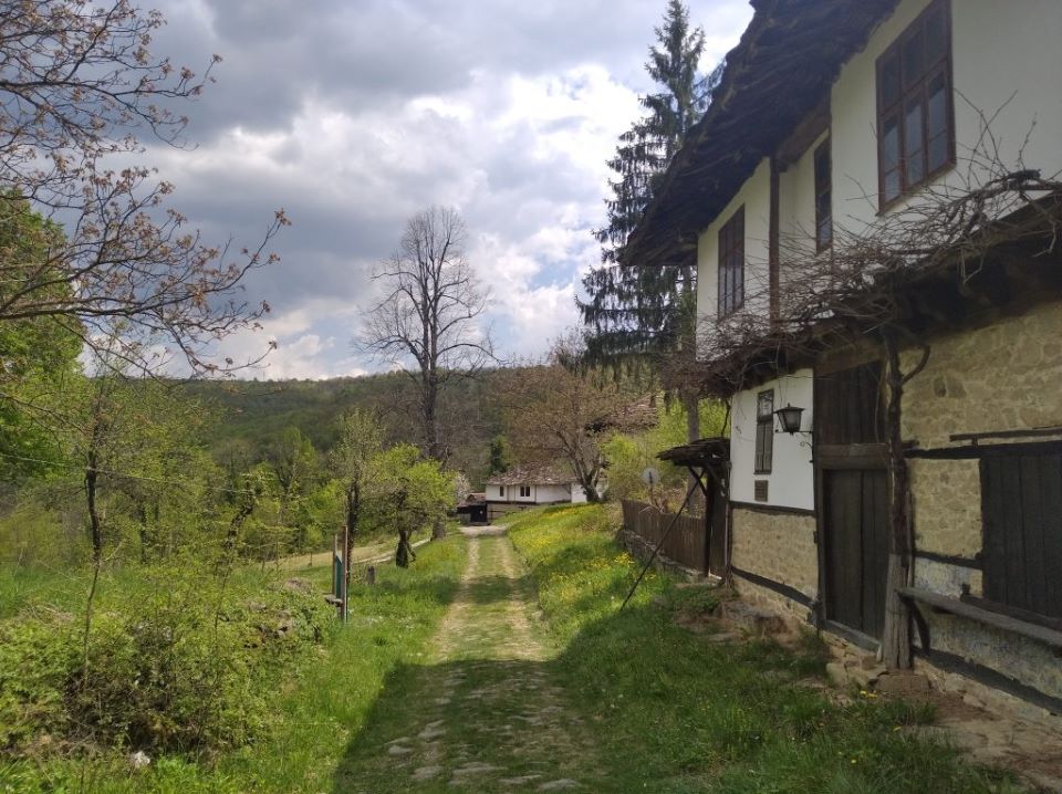
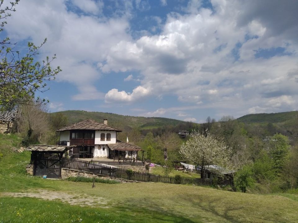
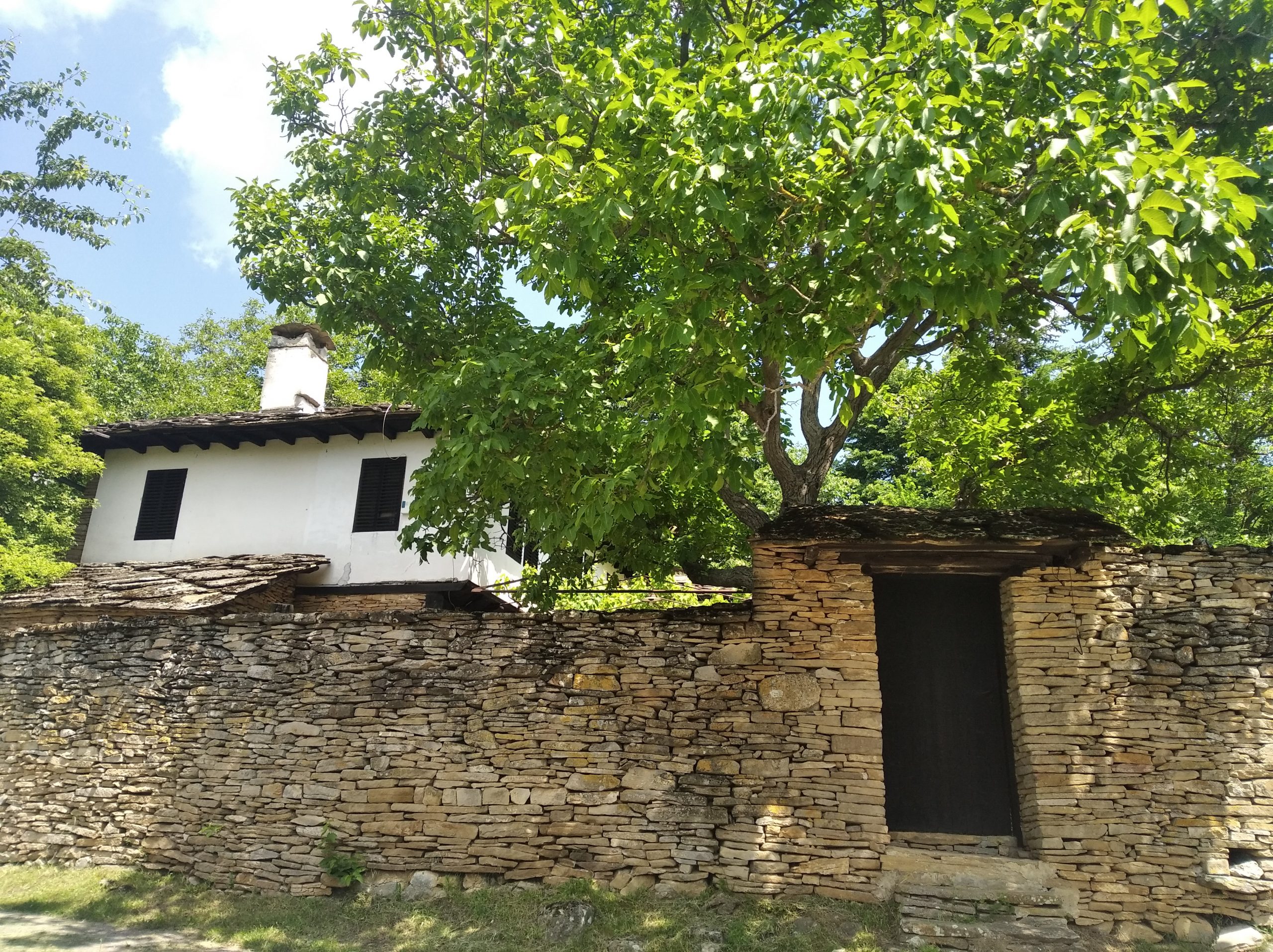
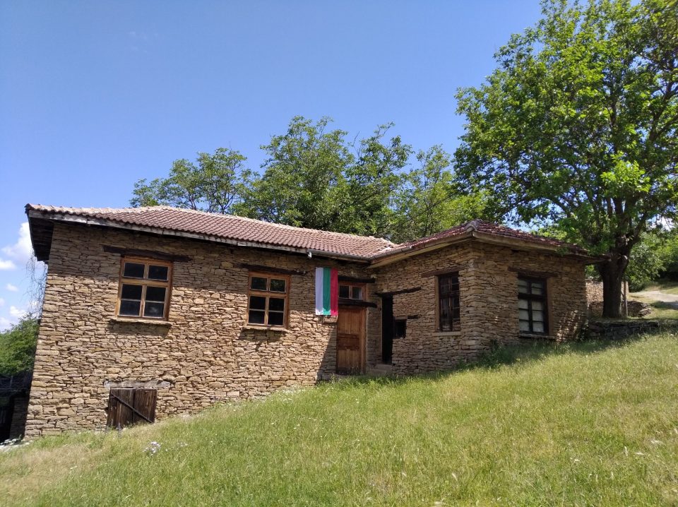
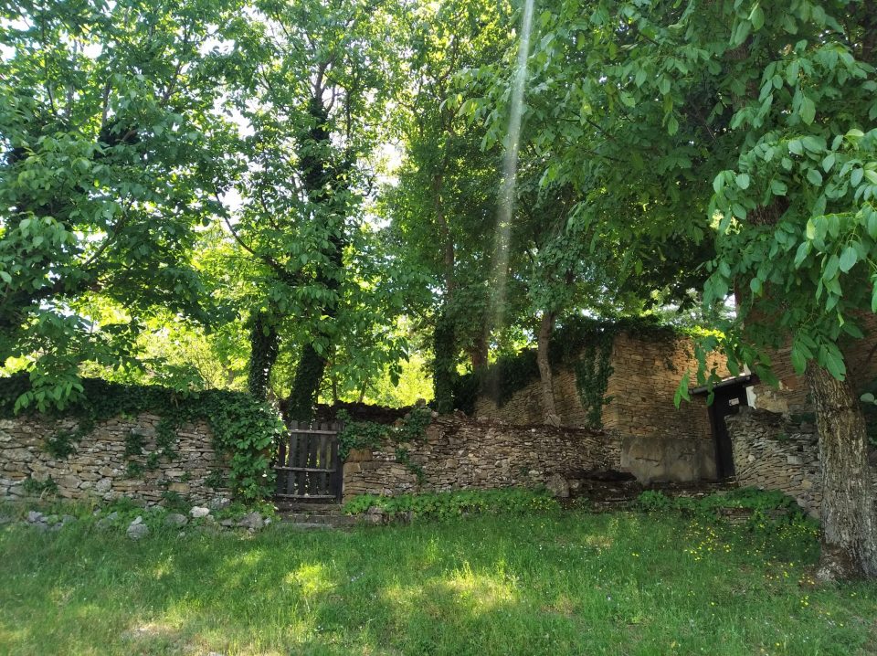
Iglika is among the villages that have still preserved their authentic appearance. They call this place “the stone village” because of the houses and walls magnificently built from the most common local material – stone. According to legend, the village was created in the 17th century by six Bulgarian families looking for a safe place during the troubled times. They were mainly builders and blacksmiths. Stone by stone, with will and great craftsmanship, they erect strong houses, perched as if on the edge of the world. Thus was born the village of Chomatsi (the old name of the village of Iglika). “Chomak” means power, strength, like the strong rock on which the first inhabitants found salvation. According to another theory, the name comes from the word “chomaga” – a thick stick that at that time was used by shepherds and herdsmen. After the Liberation, the village was renamed Iglika.
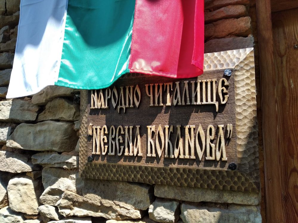
Iglika is also known for being the favourite village of actress Nevena Kokanova, who settled in this place in the mid-1980s and found her peace there in the last years of her life. Some of the movies she starred at – “Evenings at the Antimovsky Inn” and “Vampire” – were shot in Iglika. The local community centre was named after her posthumously.
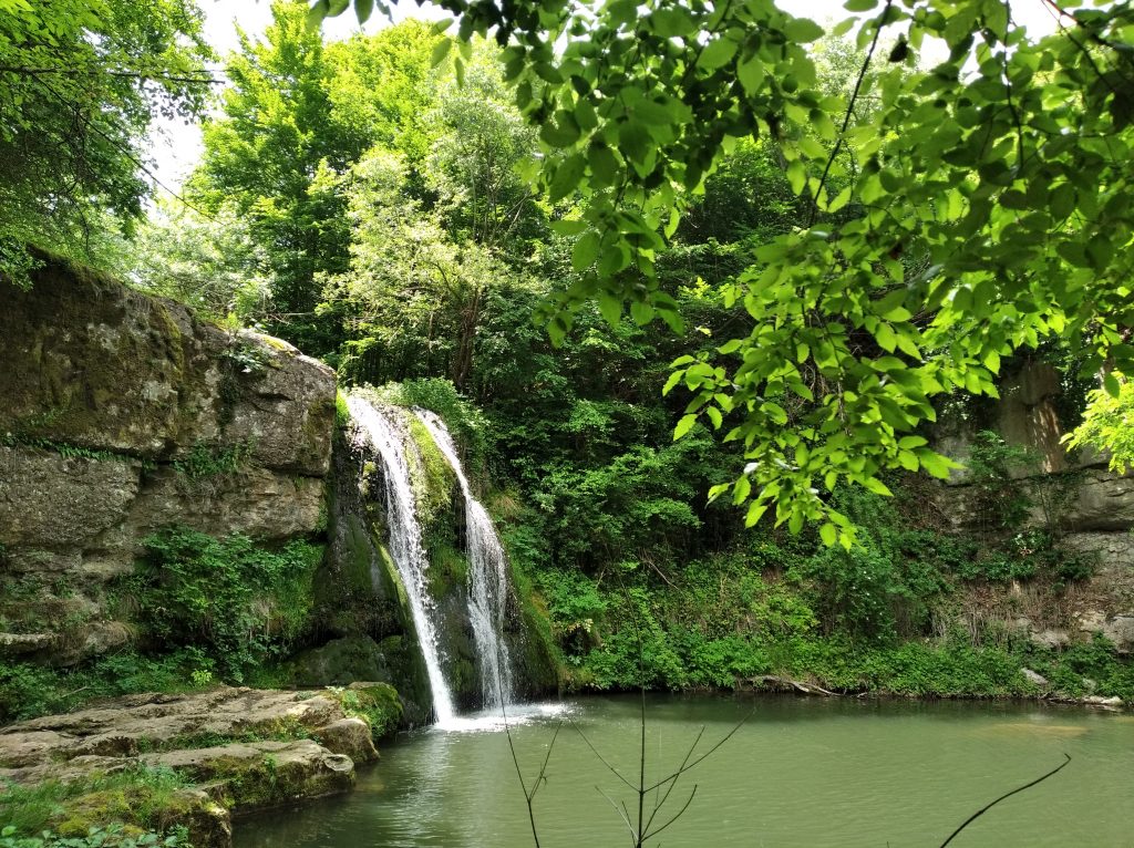
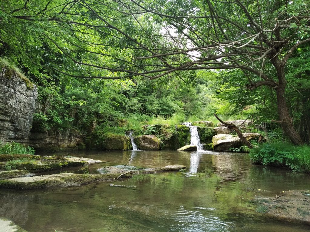
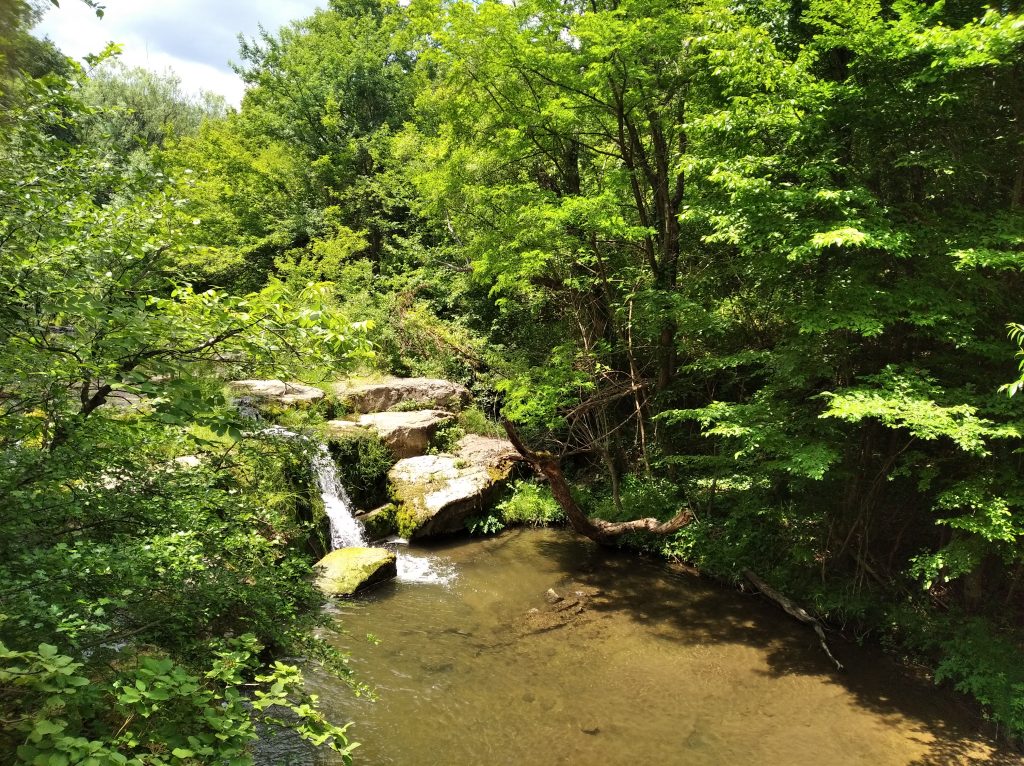
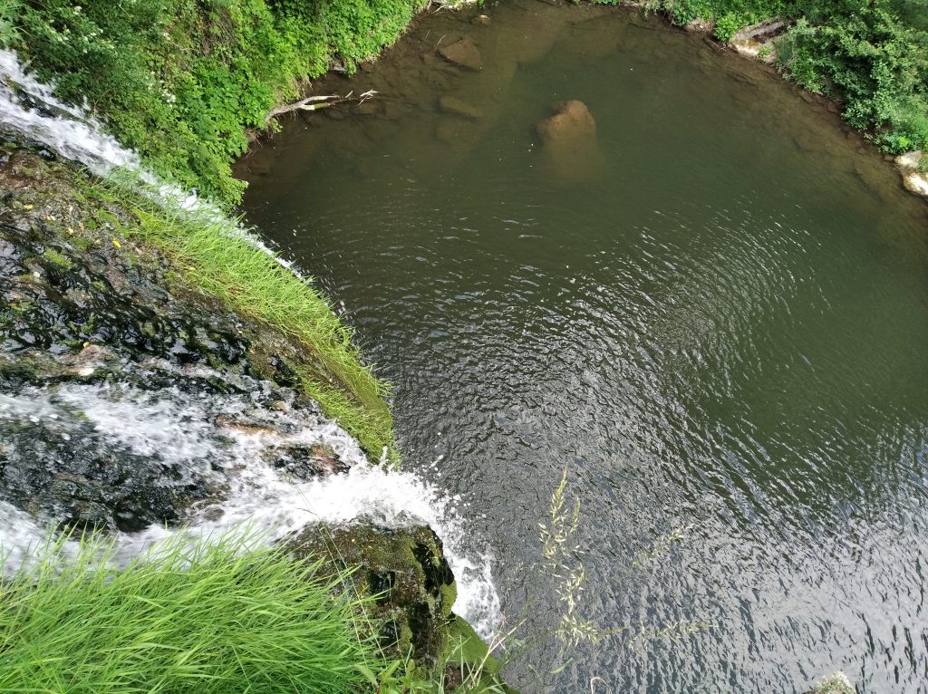
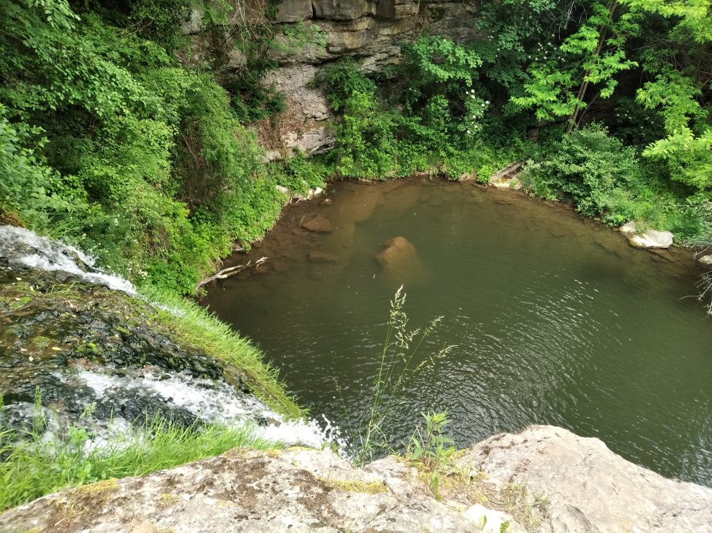
Ivanilovski waterfall is located about 9 km from Gabrovo, in the land of the small villages (hamlets) Solari and Ivanili. The height of the waterfall is about 10 meters and forms a very nice water cascade, forming a beautiful and deep 5 meters pond in the shape of a heart. The rock of the waterfall is overgrown in soft moss, which looks like a natural green carpet. The waterfall is located on a river, which in some places forms large stone islands, and after about 300 meters it flows into the Yantra River. The walk to the waterfall is light and pleasant on a dirt road, and the waterfall can be reached by a trail. Up and down the river there are also beautiful little water cascades.
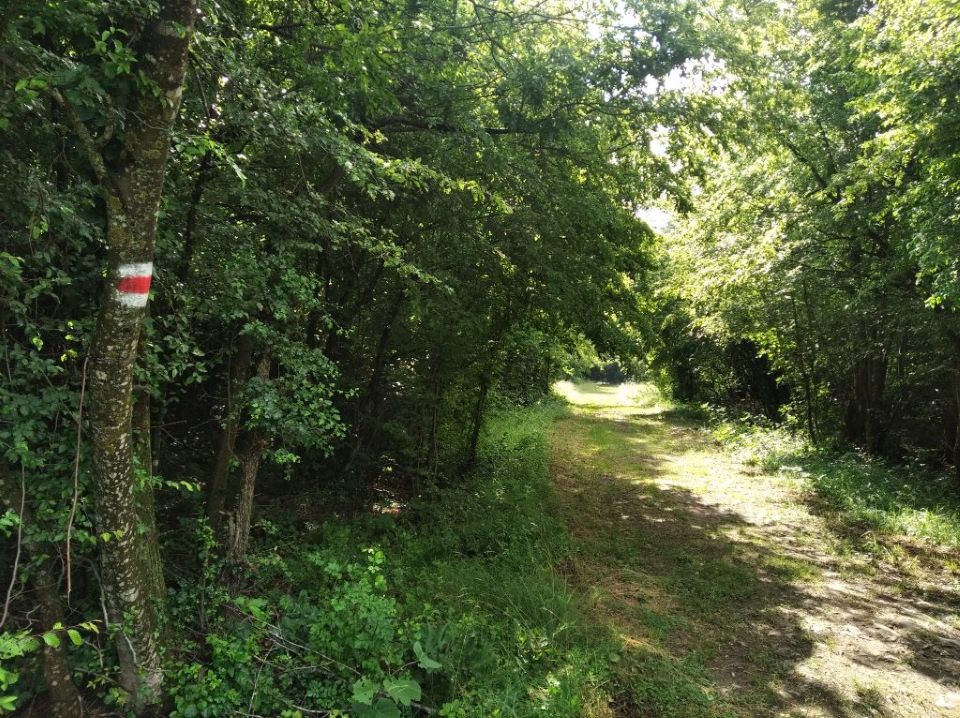
After entering the village of Solari on the main road, just before a sharp shady turn with a bridge over the ravine there is a turn to the right with signs that go down slightly to reach the beginning of the eco-trail. The route is marked with red and white strip markings and indicative arrows, and features recreation areas. After about 20 minutes from the beginning, the road enters a grove. At the end of the dirt road, which is just after the forest, where the “Forest Restaurant” is, there is a deviation to the left along a narrow path and after a short descent you can see the waterfall. The entire distance to the waterfall is covered in about 25 minutes. The way back, although slightly upwards, is again passed for the same time. The trail is light and pleasant to walk all year round. It is suitable for children and people without prior training. No special equipment is required.